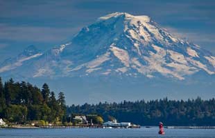
There are over 1600 Acres of Parkland on Bainbridge Island available to the public.
You
can see a brief overview of the many parks by scrolling down past the menu bar or
you can select a park on the menu bar to immediately view information and maps on
individual parks.
Parks
Aaron Tot Lot
Located at the intersection of Aaron Avenue and Grand Ave. This 0.5 acre park has a playground, horseshoe pits, grassy play area, and picnic table. This 0.5 acre park has a playground, horseshoe pits, grassy play area, and picnic table.
Battle Point Park
11299 Arrow Point Dr. NE. Closest cross streets: Arrow Point Drive & Frey Avenue.
90 acres. Picnic shelter, jogging trail, pond, soccer fields, tennis courts, softball
fields, basketball courts, roller-
Blakely Harbor Park
Blakely Harbor Park Head of Blakely Harbor.
40 acres. Former site of Port Blakely Mill, one of the world's largest sawmills in the late 1800's.
Camp Yeomalt
900 Park Avenue NE. Closest cross streets: Park Avenue and Yeomalt Pt. Dr.
3 acres. Historic scout camp with a nature trail, multi-
Eagledale Park
5055 Rose Avenue NE. Closest cross streets: Rose Ave & Eagle Harbor Drive
7 acres. Picnic shelter, sports court, sand volleyball court, play area, and off-
Fay Bainbridge Park
15446 Sunrise Drive
Fay Bainbridge State Park is a 17-
Fort Ward Park
2241 Pleasant Beach
Fort Ward Park is a 137-
Fort Ward Parade Grounds Park
Fort Ward Parade Grounds Park is approximately 1.5-
Gazzam Lake Nature Preserve
Access from the north is from Marshall Road, and access from the south is off of Deeptath Rd.
318 acres. Includes 14-
Gideon Park
274 Gideon Lane. Closest cross streets: Grow Avenue and Gideon Lane.
2.5 acres. A neighborhood park donated by heirs of the Kenneth H. Gideon family.
Grand Forest
Access from Miller and Mandus Olson Roads.
240 acres. Equestrian and walking trails. ADD more info.
Hawley Cove Park
This 11.7 acre conservancy park contains upland forest, a large wetland, and 330 linear feet of saltwater shoreline on Eable Harbor.
Hidden Cove Ballfields
Phelps Road about 3/4 mile beyond the entrance to the Hidden Cove development. Closest cross streets: Day Road and Phelps Road.
9.5 acres. Ballfields and a soccer practice area. Trails connect to open space properties.
Hidden Cove Park
8588 Hidden Cove Road. 6.1-
Island Center Park
8395 Fletcher Bay Road. Closest cross streets: Fletcher Bay and High School Roads.
3 acres. Includes an historic community hall and a picnic area.
Madison Tot Lot
This .4-
Manzanita Park
Day Road West. Closest cross streets: Miller Road and Day Road.
120 acres. Hiking and equestrian trails.
Meigs Park
Highway 305 and Koura Road. 67 acres. Being developed for nature study and trails.
Nutes Pond
Nutes Pond is 31-
Point White Pier
Point White Drive.
Historic former Mosquito fleet and ferry dock; now an ideal spot for fishing and scuba diving.
Rotary Centennial Park
This gateway park with parking, orientation, and welcoming signage is located adjacent
to SR-
Rotary Park
969 Weaver Road. Closest cross streets: Wyatt Way and Weaver Road.
10 acres. Multi-
Sands Ballfields
On Sands Avenue between High School Road and New Brooklyn.
10 acres. Full-
Strawberry Hill Park
7666 NE High School Road. Closest cross streets: High School Road and Sands Road.
18 acres. Softball fields, multi-
Ted Olson Nature Preserve
North Madison Avenue. Closest cross streets: Madison Avenue and Roberts Road.
10 acres. Nature trail and picnic area.
West Port Madison Nature Preserve
8334 NE County Park Road. Closest cross streets: Skogen Lane and County Park Road.
13 acres. Nature trail and picnic shelters.